
Rotterdam the largest port in the world? Likely
51° 54′ 33.7644” N 4° 29′ 57.264” E
12. juli 2013
The exit through the port of Rotterdam is indescribably exciting. Dynamic. Everything is incredibly large. The cranes, docks, tugs and warehouses. Kilometre after kilometre this huge port stretches itself. Through thirty unbroken kilometres side branch follows side branch, docks follows docks, crane follows crane. The largest port in the world? It is likely.
Cargo ships entering. Cargo ships on the way out. Huge. Small. Crawling into and out of the side channels. In the beginning only a few. During the early morning it becomes more. The port awakens. Rotterdam is in the process of getting the day into gear.
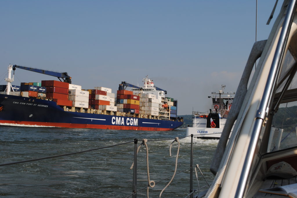
The vessels are sailing in columns on the Maas River to Rotterdam. The day is really waking up. Rotterdam moves up a notch.
We got up at 6:30 and said goodbye to Rotterdam before the clock hit seven. The harbour master in Stifting Verhagen Rotterdam – in combination with our own still a little hesitant calculations – told us that we get the most nudge in the back of the tide, if we start a little before high tide in Rotterdam and capture the southbound tide at the Maas River estuary off the Hoek van Holland. We do. The plan works.
Seven knots and later eight and a half knots, our speed through the English Channel, where we changed to go by sail in stead of motor, while we blissfully eat Kirsten’s homemade muffins with Dutch cheese and Italian sausage, sleeping half an hour alternately and otherwise enjoying a leisurely sail. High speed but completely under control because neither wind nor wave height is scary.
The Dutch have mastered the security of their inland waterway system. We change dutifully channel on VHF each time a sign on the country proclaims, that VHF channels now change to a new number, but we fail to call the station every time we come to a new VHF station, which had been recommended by the harbour master of Rotterdam City Marina. We sail gently. We are in control. Big brother in the Maas River control towers do not hear from us.
On the way out of the Maas exit we get called by a control tower.
“The yacht that just left the harbour entrance please report!”
“Ronja here!”
“Southbound or northbound?”
“Southbound”
“Have you seen the vessel just behind you?”
“Yes, we are intending to cross the traffic-line, just after they pass”
“Two more ships are coming in, please wait and keep to this channel.”
Later, we are contacted again by the control tower and asked to turn to the south, after the last of the two incoming vessels have passed. The vessels are sailing in columns on the deep-water route to the Maas River and Rotterdam. The day is really waking up. Rotterdam moves up a notch, while we have said farewell to a dutch adventure, that has lasted almost a year.
Log-book: Sailed distance: 75 nautical miles with the tide in the back of the Maas River and down to South Holland and Belgium. Time: Departure 6.50 from Rotterdam. In Zeebrugge, Belgium, 17.00. Crew: Kirsten and Per. Weather: North western wind maximum 7 meters per second. Wave height: 1 meter
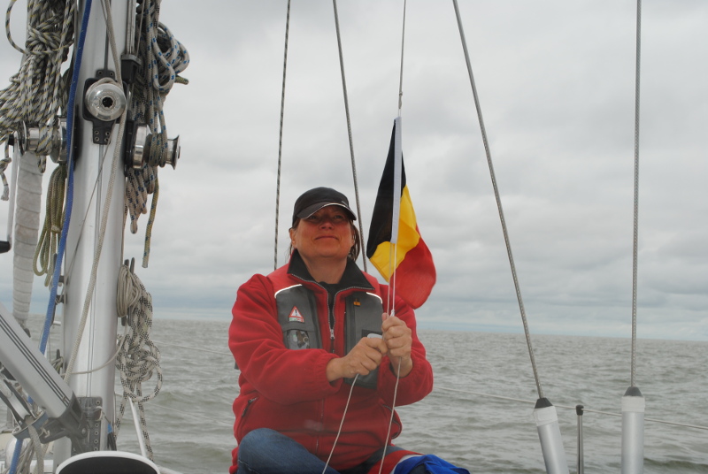
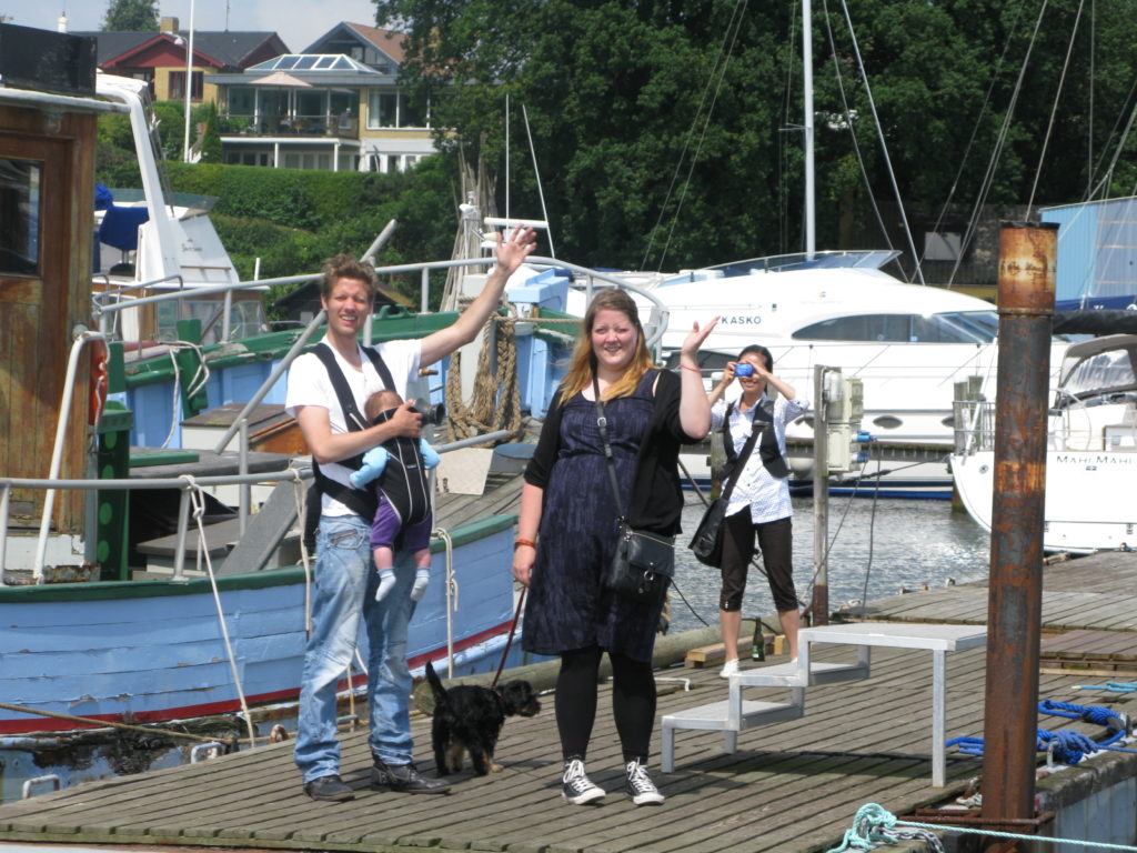
Goodbye Holland. Hello Belgium. Kirsten changes our guest-flag

Sailing the Staande Mastroute in Holland
53° 19′ 51.6972” N 6° 55′ 28.056” E
After spending a few days on the German island Norderney we head towards Delfzilj. The city are chosen, because from here it is possible to sail “inside” Holland, through a system of channels, that you can pass with your mast still up.
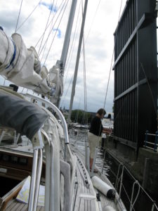
At some locks or bridges you pay a few euro in a wooden shoe from the end of a fishing rod
Five days – including two resting days – it took us to sail from Delfzilj to the great dutch lake called Ijselmeer. We passed 49 bridges and five locks. It worked perfectly. The bridges goes up, when we approach. As a rule. Sometimes we call via VHF. Some bridges charge a toll – five euro put in a wooden shoe, hanging from a fishing rod, which a bridge-employee lowers down towards us.
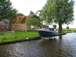
On our way we pass the one idyllic dutch town after another. The houses are located with manicured gardens facing the canal. The flowers are in full bloom, and on the edge a lot of boats are moored.
-
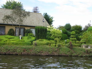
- In Holland you show your best to the waterside
-
- Every home has a boat

“Hold up” at sea. The police boards our boat and gives us a fine
53° 42′ 8.3748” N 7° 9′ 56.6201” E
Tuesday – July 13, 2012
Friday we decide to leave Helgoland heading for the Frisian island, Norderney.
The wind is against us again. But the weather forecast raised the prospect, that the wind will gradually turn during the day, and with the expectation of this we hoist the mainsail in the harbour of Helgoland, and then using the engine with the mainsail as stabilizing support sails we are ready to let the sail take over when the wind shifts.
We should not have done this.
The direct course towards Norderney brought us through not just one but two traffic separation zones, deep-water routes for large tankers and container ships. One for the river Jade, one for the river Elbe.
There was barely a ship in sight, those few who were, we knew exactly where were, so we “crossed” into the zone instead of taking the perscribed angle of 90 degrees. When such a zone is up to 10 km wide, you win both time and comfort by setting the direction after the wind and the goal instead of the regulations.
We should not at all have done this.
Far out on the horizon, we saw something that resembles a coastguard ship. When we saw it we turned on the VHF on channel 16 in order to hear any messages.
After a while, it looked as if the coastguard-ship had put a small boat in the water, and that this boat was heading towards us.
Damn it! There was no doubt. A high-speed inflatable boat was heading directly toward us. We turned Ronja into the wind, turned off the propellars and let the mainsail flap in the wind.
Shortly after, we were invoked. Four burly policemen in the dinghy. They let us understand, that they wanted to get on board. Very jovially. They joked that they needed lunch and slapped their stomachs.
It was not much about lunch. Two officers boarded Ronja. With pistols in their belts and a binder with forms and papers under the arm.
“We would like to explain why we are here,” they said. That is, the one spoke. The other took notes. “But first we’d like to see some documents – your passport, VHF license, proof of sailing education, nationality proof and evidence of ownership of the vessel.”
Luckily we had our documents under control, and when they subsequently asked for our charts, these were also OK. All charts were from 2012.
“We are here because we have observed, that you have crossed a traffic zone at an angle that differs 30 degrees from the rules of the sea,” said the officer.
He was absolutely right. We knew this in advance, and as if this were not enough, he brought a radar printout from the coastguard ship, where people apparently had followed us for a long time. “Here’s your course,” he said. “We called you on VHF pm. 10:32, but you did not answer”. This was before we turned the VHF on.
However this was only one thing. Then came the second. “We can look at course stability, that you both have had sails up and the engine on … It is only allowed under maritime law, if you with an inverted cone hoisted half up the mast shows that you are a sailing ship that is currently propelled to power” .
“Do you have a cone on board?” asked the officer.
“Certainly,” answered Per. “It is in the starboard bench.”
“Then you must draw it up now,” insisted the officer.
“Can’t we just take down the sail, so we are only motoring?”
“Your decision,” said the officer. And down came the sail.
“You have violated two rules. You will through your own authorities receive a fixed penalty notice of two or three hundred Euros. ”
Kirsten said that they should rather have said yes to get the lunch, which they themselves had proposed before they boarded us. The officers laughed politely and declined the offer. On the whole they were pretty professional. They did not go into discussions whether there had been any danger or any ships at all in the vicinity. They only focused on the fact, that two rules were violated.
They said goodbye and wished us a good journey, as they boarded their dinghy.
“Fucking German bureaucrats,” snorted Kirsten, when they were sailing away. “It is similar to getting a fine for ignoring a red light at a pedestrian crossing in the middle of the night, after having ensured that there is absolutely no traffic.”
Per was more relaxed over the incident. “We did something, we should not have done.” In his opinion, it was a fun and interesting experience.
The experience has led Kirsten, every time she sees a vessel that looks like a coastguard ship, to get a nervous twitch and to ask Per, if what we’re doing at the moment is actually completely legal.
After 12 hours rather good sailing – also with both sails up – we arrived in Norderney.
Log-book: Start of sailing 8.00. Destination: Norderney. Arrival 17.00.

Farewell to Denmark. The adventure awaits
55° 2′ 23.082” N 10° 40′ 23.3076” E
July 5. – July 9, 2012
Five days ago Ronja left her permanent home port in danish Thurø Bund.
Lasse, Tianling, Nellie, Emilie and Molly waved goodbye from the pier, when we left on July 5.
After a short stop on danish island, Marstal, too meet with Hanne and Ebbe, the wind is favourable for Kiel. Ten meters per second from northeast, and 35 miles later we call Düsternbrook Marina in Kiel.
We do some sightseeing in Kiel and use a day for cleaning and minor repairs on the boat and the purchase of charts.
Sunday morning we go through the lock in the Kiel Canal, along with 10 other sailors and a giant container ship. It’s a bit scary to be in the same lock with such a huge ship.
Full concentration. The Kiel Kanal is relatively wide, but so are the big container-vessels
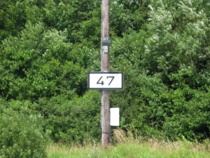
Kiel Canal is 100 kilometres long and with german precision the distance is marked with kilometre signs for every half kilometer. Although the channel as such is rather boring to sail on, we enjoy the good weather and the fact, that we are now heading out towards the big oceans.
After a short and heavy thunderstorm, the wind reaching 16 meters pr second, we call Brunsbüttel after 8½ hours sailing with the motor. Here is a small marina, located just before the lock out to the river Elbe. From our berth we follow the flow of huge ships going through the locks both day and night.
Brunsbüttel do make you a bit depressed. We meet lots of oil tanks and chemical factories. On the brink of the marina is a small restaurant, “Torhaüschen“. It has three palms standing in great pots in front of the restaurant. We are approaching the south?