
Still we do not understand the tide completely
53° 19′ 48.864” N 6° 55′ 51.1176” E
July 15, 2012
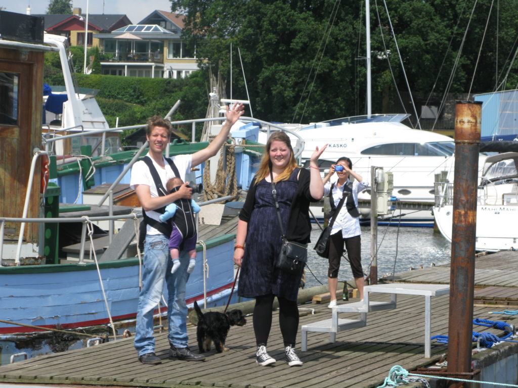
Up at six o’clock. Immediately we start. We follow Jörg’s advice. Beautiful morning. Even with small pieces of blue and glimpses of the sun. But the wind is again contrary, and waves are higher than we know from home.
We are – mildly speaking – uneasy in the sea. We have to pull op the main sail to stabilise the boat’s movements. Per would like to go on deck and hoist the sail, but Kirsten insists that it’s her job. She believes, that the chances are greater, that Per can save her from the water, if she falls, than for her to save Per.
Jörg’s schedule does not hold at all. It takes us six hours to reach Borkum, not four. In addition it takes a few hours to round this island, and we completely misses the tidal push in the Ems river, which should have given us an extra four knots on our way to dutch city Delfzijl.
Ems River is depressingly sad. Huge power plants dominates the entrance. And with no other boats on the water all seems desolate and bleak. Add to this the constantly gray weather.
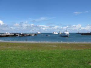
On a “plaat”, as the Dutch call the surfaces exposed when the tide recedes, we see a seal. Further along the same plaat are a bunch of tourists boarding a ship after having been on a Wadden Sea tour.
Tide is a strange phenomenon. Now we have sailed in it for a week, and we still do not understand it completely, despite practical experience and tons of tidal informations.
But it is no longer quite the mystery, that it was before, we set keel into it for the first time.
Our first observation is, that you can avoid it at a great lenght. If you consciously opt the areas being reclaimed and ensures, that the depth even at low tide is ok, then only remains the question of getting more or less push out of the tide. The one and a half knots with or against, that we have known at home in Danish Svendborgsund may well in these waters be four knobs counter or co-current flow. It can turn into an advantage, and it can turn into a disadvantage.
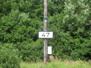
Our second observation is that certainty about the current status of high tide or low tide can make it possible for you to pass areas where you otherwise would think: “Damn it! Here is not deep enough.” Proper planning gives you opportunities. Jörg gave us a copy of the program “wxtide47” that graphically tells you, where you at a given location are in the tidal cycle.
Our third observation is, that both the Germans and the Dutch have developed amazing engineering skills in creating tidal ports where pontoons rolls up the barrows, telephone pole-like pillars, and you can sleep sweetly, while water moves both two, three, four or more meters up and down below you.
Our fourth observation is more of an assertion: It does not matter if you get stuck on the ground, because if the tide is with you, eventually it will set you free again.
Delfzijl is a pure, unadulterated industrial city. But the city’s marina, Neptunus, is prima. We sleep well after 12 hours in the high waves.
Log-book: Sailed 6.00. Destination: Delfzijl in the Netherlands. Arrival 18:00. Weather: Wind from the west 10 meters per second. Almost contrary to our sailing direction. Big waves. Hammering up and down. Tiring sailing.

An interesting German spa- and wellness town
53° 42′ 8.3736” N 7° 9′ 56.6208” E
July 14, 2013
We are in Norderney. We are jogging seven kilometers in the town to get a sense of where we’ve arrived.
A spa town. Huge. Almost an industry. Hundreds of hotels and boarding houses, parks, cafes and a waterfront, which is powerful like the North Sea in Denmark. Very neat, very stylish, very beautiful and very subdued. This is apparently how the Germans have cure-vacation.
Back on the boat we do some cleaning. Later we cycle to town to shop. Falling into conversation with the owner of the neighboring boat, Jörg from Cologne, which has his Nauticat 33 lying in Ijselmeer and who knows the tidal waters and the Frisian Islands in and out.
The tips pours out of him. About tides, how to sail in the Wadden Sea, good advice on different cities, and advice on how to put up the boat up for the winter near Amsterdam.
He gives us some charts, a tide application for our computer and an auto map of the entire Netherlands. Good stuff.
“You have to leave at six o’clock in the morning,” he counsels us, looking at the tide-tabels. Damn! We were intending to sleep late tomorrow.

“Hold up” at sea. The police boards our boat and gives us a fine
53° 42′ 8.3748” N 7° 9′ 56.6201” E
Tuesday – July 13, 2012
Friday we decide to leave Helgoland heading for the Frisian island, Norderney.
The wind is against us again. But the weather forecast raised the prospect, that the wind will gradually turn during the day, and with the expectation of this we hoist the mainsail in the harbour of Helgoland, and then using the engine with the mainsail as stabilizing support sails we are ready to let the sail take over when the wind shifts.
We should not have done this.
The direct course towards Norderney brought us through not just one but two traffic separation zones, deep-water routes for large tankers and container ships. One for the river Jade, one for the river Elbe.
There was barely a ship in sight, those few who were, we knew exactly where were, so we “crossed” into the zone instead of taking the perscribed angle of 90 degrees. When such a zone is up to 10 km wide, you win both time and comfort by setting the direction after the wind and the goal instead of the regulations.
We should not at all have done this.
Far out on the horizon, we saw something that resembles a coastguard ship. When we saw it we turned on the VHF on channel 16 in order to hear any messages.
After a while, it looked as if the coastguard-ship had put a small boat in the water, and that this boat was heading towards us.
Damn it! There was no doubt. A high-speed inflatable boat was heading directly toward us. We turned Ronja into the wind, turned off the propellars and let the mainsail flap in the wind.
Shortly after, we were invoked. Four burly policemen in the dinghy. They let us understand, that they wanted to get on board. Very jovially. They joked that they needed lunch and slapped their stomachs.
It was not much about lunch. Two officers boarded Ronja. With pistols in their belts and a binder with forms and papers under the arm.
“We would like to explain why we are here,” they said. That is, the one spoke. The other took notes. “But first we’d like to see some documents – your passport, VHF license, proof of sailing education, nationality proof and evidence of ownership of the vessel.”
Luckily we had our documents under control, and when they subsequently asked for our charts, these were also OK. All charts were from 2012.
“We are here because we have observed, that you have crossed a traffic zone at an angle that differs 30 degrees from the rules of the sea,” said the officer.
He was absolutely right. We knew this in advance, and as if this were not enough, he brought a radar printout from the coastguard ship, where people apparently had followed us for a long time. “Here’s your course,” he said. “We called you on VHF pm. 10:32, but you did not answer”. This was before we turned the VHF on.
However this was only one thing. Then came the second. “We can look at course stability, that you both have had sails up and the engine on … It is only allowed under maritime law, if you with an inverted cone hoisted half up the mast shows that you are a sailing ship that is currently propelled to power” .
“Do you have a cone on board?” asked the officer.
“Certainly,” answered Per. “It is in the starboard bench.”
“Then you must draw it up now,” insisted the officer.
“Can’t we just take down the sail, so we are only motoring?”
“Your decision,” said the officer. And down came the sail.
“You have violated two rules. You will through your own authorities receive a fixed penalty notice of two or three hundred Euros. ”
Kirsten said that they should rather have said yes to get the lunch, which they themselves had proposed before they boarded us. The officers laughed politely and declined the offer. On the whole they were pretty professional. They did not go into discussions whether there had been any danger or any ships at all in the vicinity. They only focused on the fact, that two rules were violated.
They said goodbye and wished us a good journey, as they boarded their dinghy.
“Fucking German bureaucrats,” snorted Kirsten, when they were sailing away. “It is similar to getting a fine for ignoring a red light at a pedestrian crossing in the middle of the night, after having ensured that there is absolutely no traffic.”
Per was more relaxed over the incident. “We did something, we should not have done.” In his opinion, it was a fun and interesting experience.
The experience has led Kirsten, every time she sees a vessel that looks like a coastguard ship, to get a nervous twitch and to ask Per, if what we’re doing at the moment is actually completely legal.
After 12 hours rather good sailing – also with both sails up – we arrived in Norderney.
Log-book: Start of sailing 8.00. Destination: Norderney. Arrival 17.00.

The wind howls. The rain splashes. We take an extra day at Helgoland
54° 10′ 33.3510” N 7° 53′ 38.1156” E
July 12, 2012
The wind howls. The rain splashes. The wind direction is counter to the direction we intend to go. We decide to spend the day on Helgoland.
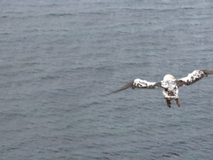
In a gap between two rain-bursts we head to wander around the island. Interesting trip. Along the way, posters explain about the island’s history. Dramatic fighting between England and Germany on the ownership of the island. We also see gulls, guillemots and a lot of other birds, who lie windswept on shelves in the rocks.
Everything is, understood, in the German manner. Paths, paved with fences on both sides and especially landscaped vantage points. Not like in Anholt in Denmark with complete freedom to move anywhere you please.
But it’s still OK. Informative. Beautifull. Wind-blown. Very different.
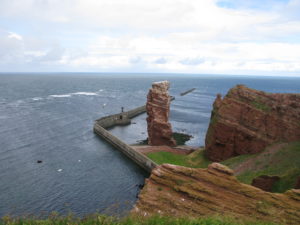

Helgoland is actually fun. Very different
54° 10′ 33.4408” N 7° 53′ 48.1156” E
July 11, 2012
We sail in the Wadden Sea. Strange to think that six hours later, the water we’re looking at will be gone. We stick to the marked channel. 15 miles later we are out of the Elbe. We are in the North Sea, the part called the German Bight.
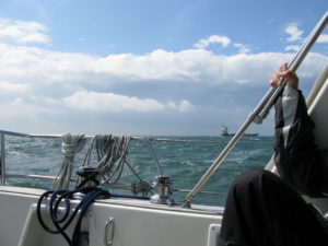
The waves have become larger and larger, as the river has turned into sea. Again, we head directly into the wind, and the tidal advantage, we secured ourselves from Cuxhaven to the North Sea, can not catch up with the force of the wind. After three hours of sailing, our speed of motor is down between two and three knots. We knock up and down in the waves and hardly feel, that we move forward. Annoying as there are still 60 nautical miles to the target of the day.
We decide to make new plans. We consider Bremerhaven (28 miles) and Wilhelmshaven (30 miles), but we choose instead Helgoland (16 nautical miles), because winds and currents are more favorable for Helgoland.
The waves are still high. Kirsten says they are three meters high. I believe they are a lot less. But it feels rough. The genoa sail has got a rope. The mainsail is not up at all. The motor works for the progress. Rain washes down most of the time. The wind keeps as promised: 9-13 meters per second, but it just feels more violent, when the waves at the same time are pretty huge.
We call Helgolands old military port at 15 o’clock. Tired, hungry and a little amazed to be right here, where we would previously have wrinkled our noses of this duty-free and tourist-invaded island.
After a late lunch we take a walk on the island. It’s actually fun. Very different. A world of its own.
There is a little Anholt (danish island) over it: Large natural areas. Viewpoints and beaches. But there is also something Las Vegas over it. Lots of cafes, restaurants, hotels and liquor stores ( “Shiffausrustüng” they are called close to the port).
You can get married on the island for € 898, including a tour of the old bunkers and three nights at a hotel. On the island there are maybe 100 stores. Two thirds trade with perfume and hard liquor.
Historically, Helgoland has been a center of corsairs and pirates. Today piracy assumes new forms. Everything costs money: Toilet, shower, electricity. Throw immediately a coin, thank you.
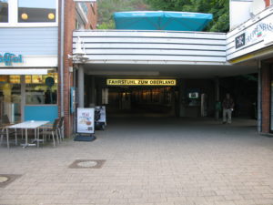
All cars are micro-small and runs on electricity. Bicycles are prohibited. Scooters allowed. Urban city is divided into “Unterland” at harbour-level and “Oberland” up on the rock. An elevator lifts the lazy from one part of town to the other. € 1.20 for a single journey with elevator.
One rain shower follows the next. The night is filled with thunder, lightning, strong winds and rain. It is rough on the North Sea.
Log-book: Sailed: 8.00. Destination: Borkum or Delfzijl. Arrival at Helgoland 15:00. Weather: Southwest 9-13 m / s. Rain.

We sail gently out into the Elbe estuary, now we really are on our way out into the world
53° 52′ 13.5264” N 8° 42′ 48.3372” E
July 10, 2012
The lock is open and waiting for us. Seven or eight boats are already in place. This lock is apparently free. You only pay one end of the Kiel channel.
Now we are really on our way! The fairytale opens with the lock gates, and we sail gently out into the Elbe estuary on our way out into the world.
The power is noticeable. Although we have the wind contrary, we log up to 9.4 knots. Ronja never sailed that fast before.
The water does not conspicuously differ from what we know from home. And yet. The traffic of large commercial ships are impressive, and together with the strong current, we get the feeling, that have come out into something big and different. The water is brown like clay. The light in the air takes color from that.
Skipper is happy. Finally we have a large sea in front of us.
The entrance to Cuxhaven is special. We were warned, that there could be a current of four knots across the entrance. That was right. Strange to feel your own ship moved by forces that much larger than yourself. We are taken sideways, but with extra revolutions from the engine we manage to get into the port.
We go for the City marina, get a bridge operator open the bridge, and find ourselves an excellent berth in the middle of the city.
We walk the city. Buy charts, tide tables and food. It rains. But we do see most of the city, and it certainly has charm. A seafaring town with lots of activities related to shipping, fishing and a manifestly huge industry transporting German tourists to the duty-free mecca of Helgoland. Or out to see seals in the Wadden Sea.
A blessed night. In the middle of the city. But quiet. Tomorrow we will leave early with the high tide.
Logbook: Sailed 8.00. Destination: Cuxhaven. Arrival: 11.30.

Farewell to Denmark. The adventure awaits
55° 2′ 23.082” N 10° 40′ 23.3076” E
July 5. – July 9, 2012
Five days ago Ronja left her permanent home port in danish Thurø Bund.
Lasse, Tianling, Nellie, Emilie and Molly waved goodbye from the pier, when we left on July 5.
After a short stop on danish island, Marstal, too meet with Hanne and Ebbe, the wind is favourable for Kiel. Ten meters per second from northeast, and 35 miles later we call Düsternbrook Marina in Kiel.
We do some sightseeing in Kiel and use a day for cleaning and minor repairs on the boat and the purchase of charts.
Sunday morning we go through the lock in the Kiel Canal, along with 10 other sailors and a giant container ship. It’s a bit scary to be in the same lock with such a huge ship.
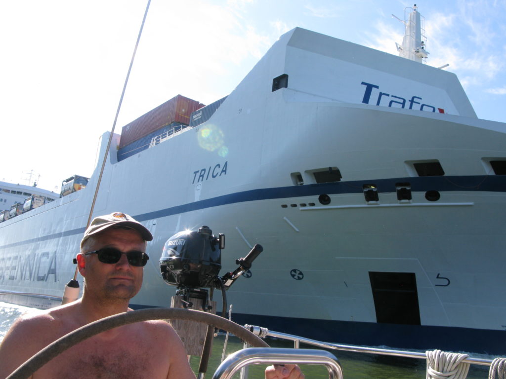
Full concentration. The Kiel Kanal is relatively wide, but so are the big container-vessels
Kiel Canal is 100 kilometres long and with german precision the distance is marked with kilometre signs for every half kilometer. Although the channel as such is rather boring to sail on, we enjoy the good weather and the fact, that we are now heading out towards the big oceans.
After a short and heavy thunderstorm, the wind reaching 16 meters pr second, we call Brunsbüttel after 8½ hours sailing with the motor. Here is a small marina, located just before the lock out to the river Elbe. From our berth we follow the flow of huge ships going through the locks both day and night.
Brunsbüttel do make you a bit depressed. We meet lots of oil tanks and chemical factories. On the brink of the marina is a small restaurant, “Torhaüschen“. It has three palms standing in great pots in front of the restaurant. We are approaching the south?